Round Trip Distance: 3.2 miles
Elevation Gain: 800 feet
High point: 2160
Map: Green Trails No. 206
Passes: Discover Pass
If you haven’t been up to Dirty Harry’s Balcony, it’s time to go! Why, you ask? Well, it’s simple really. Dirty Harry’s Balcony boasts great views, is close to North Bend and offers a fantastic place to spread out and picnic without having to be concerned about invading the next picnic over. Named after an iconic Northwest logger, “Dirty Harry”, remains of logging-past can still be found rusted and scattered about in places. Nature has healed the scars of man, and the trail looks much like any other in the Northwest, only with fewer boot prints. This little gem is really underused and under-discovered! Hiker friends, meet, Dirty Harry’s Balcony!
Directions:
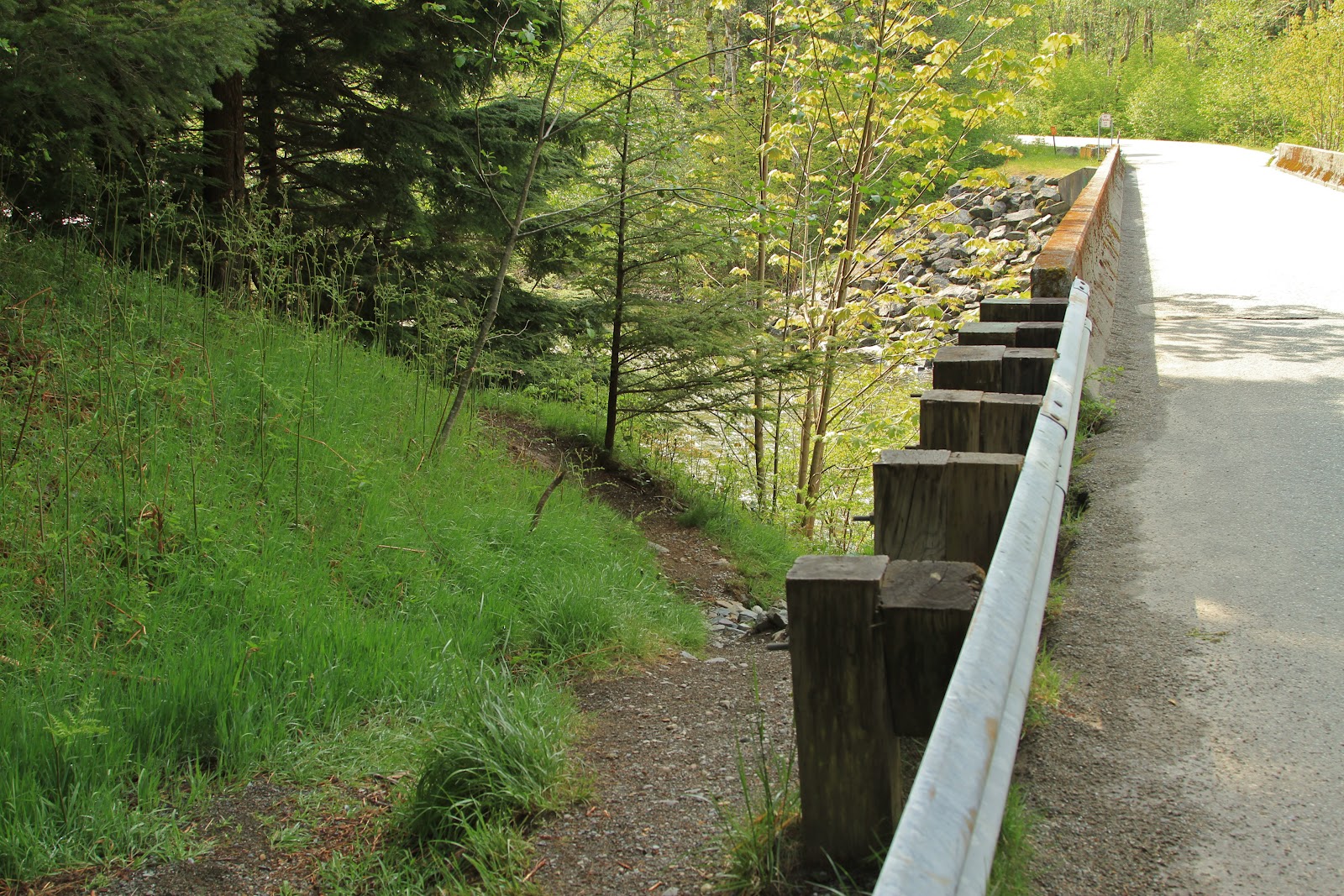
Head east on I-90, and take exit 38. Turn right off the exit (south) and follow the signs to the Fire Training Academy. The road dead-ends at a gate where you’ll find lots of parking spots and a trailhead. Hang your Discover Pass and walk the road, past the gate. Cross over a bridge and immediately look to your right. That crazy little trail which starts at the end of the guard rail is the trailhead. There is one further down too, but the guardrail trail is a bit easier on the knees and ticker.
On the trail:
Head up the trail and a few paces in, arrive at the old logging road which is wider and more travelled. From here, it gets tricky, but very manageable. There are lots of great places to rock climb in this area, and little trails head off everywhere. The trails here are primitive and not wide cruising lanes, so watch your footing. The best possible advice I can give you is to follow the signs which are warning of underground cables, they will eventually lead you to the turn off for the balcony, so let them guide you. Most trails will eventually connect back up with the main one, so if you make a mistake, you’ll soon enough be back on track. Up, up, up the trail climbs, following the signs and having you climb over a few blowdowns. Look for cairns (rock stacks) and stick arrows leading you up the correct course and the widest trail in the area. As you huff it uphill, watch for rusted debris here and there, which speaks of days gone by and escorts you as you get closer to the balcony. Look up, as sometimes it’s hanging from trees!
Eventually, the trail reaches a small plateau in the forest understory. Look for a stack of sticks with a trail arrow pointing you towards the balcony and walk out on the sturdy, wide overlook. An old milk crate and two rock piles are further up the trail, if you miss the sticks. Either small trail will get you over to the balcony. If you make a mistake and keep climbing up Dirty Harry’s Peak, eventually, you’ll be able to look down and see the balcony (large flat rock) and it will dawn on you where you should have turned. It might sound complicated, but it’s really quite easy to find! Keep your eyes out for alligator lizards near the rocks and enjoy the floral scented air. When you’ve had enough, head back the way you came and check Dirty Harry’s Balcony off your ‘must explore’ list.
Late May flowers: penstemon, bleeding heart, yellow violet, twin flower, spreading phlox, magenta paintbrush,
 |
| Walk through this gate and down the road |
 |
| After passing this guardrail, look right- this is the trail! |
 |
| So-green-it-hurts as you hike |
 |
| Bleeding heart |
 |
| Follow the "Warning buried cable signs" as you go up, up, up! |
 |
| Life uncurls from a dormant winter |
 |
| Keep an eye out for trail markers as you head up, like this arrow and cairn |
 |
| Find this arrow and pile of sticks, which leads you to the balcony |
 |
| Campfire remains on the balcony |
 |
| Looking east from the balcony |
 |
| Interstate ribbons |
 |
| More interstate ribbons and the Snoqualmie River |
 |
| Looking south |